3 Days Danakil Depression Tour
Get ready to dive into a journey unlike any other with our 3-Day Danakil Depression Tour Itinerary. A high-octane adventure across some of Earth’s….
Itinerary Details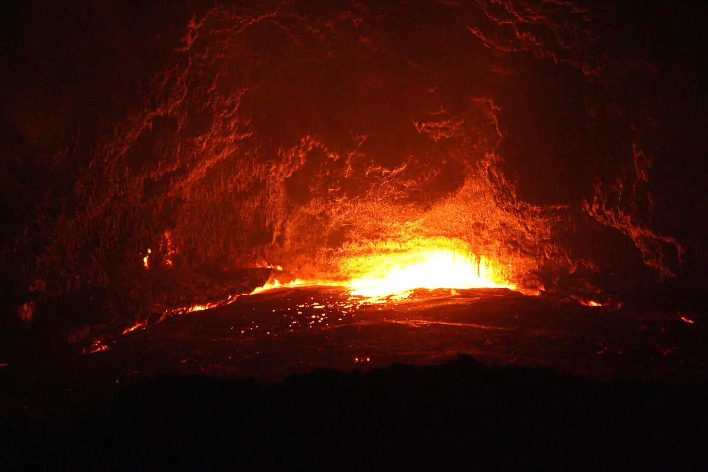
There’s a stretch of northern Ethiopia where the ground steams, the lakes are acid, and the air can feel like standing in front of an open oven. This is the Danakil Depression – a place so extreme that scientists study it as a stand-in for early Earth, and possibly even Mars. It’s also, somehow, home to a thriving nomadic culture that has worked its salt flats for generations.
If you’ve stumbled across photos of neon-yellow sulfur pools or a glowing lava lake at night, there’s a good chance you were looking at this exact spot. Here’s what the Danakil Depression actually is, why it exists, and what it takes to see it in person.
The Danakil Depression is a low-lying desert basin roughly 200 km long and 50 km wide, sitting across the northern Afar Region of Ethiopia and reaching into Eritrea. At its lowest point, it drops to about 125 meters below sea level, making it the third-lowest point on the African continent.
Geographically, it forms the northern tip of a much larger feature called the Afar Triangle (also known as the Afar Depression). To the west, it’s bordered by the Ethiopian Highlands; to the east, by the Danakil Alps, beyond which lies the Red Sea.
National Geographic has described it as one of the cruelest environments on the planet – and that’s not an exaggeration. Between the heat, the volcanic activity, and the remoteness, the Danakil Depression regularly tops lists of the most inhospitable places on Earth.
The Danakil Depression exists because the ground beneath it is being pulled apart. It sits at a triple junction, the meeting point of three tectonic plates: the Nubian plate, the Somali plate, and the smaller Danakil (or Arrata) microplate. As these plates diverge, the crust between them stretches, thins, and sinks – creating the depression itself.
This isn’t a slow, purely historical process. The plates are still separating today, at a rate of roughly 1 to 2 centimeters per year in places. It’s a small number on a human timescale, but geologically, it’s fast enough that the region is one of the most seismically and volcanically active places on the planet.
Here’s the part that makes geologists especially excited: the Danakil Depression is one of the only places on land where you can watch new oceanic crust forming in real time. As the plates pull apart, magma rises to fill the gap, cooling into fresh crust – the same basic process that builds ocean floors, just happening on dry land for now.
Because the crust here is unusually thin, heat from below reaches the surface easily. That’s the underlying reason the region is dotted with volcanoes, geysers, hot springs, and geothermal fields.
Read more about East African Rift Valley
Average temperatures in the Danakil Depression hover around 35°C (95°F) year-round, and it’s not unusual for daytime highs to push past 48°C (118°F) during the hottest months. Combined with minimal rainfall – typically only 100 to 200 millimeters a year – it’s frequently cited as the hottest inhabited place on the planet.
Unlike many extreme-heat records that apply to uninhabited deserts, people actually live and work here full-time, which is part of what makes the Danakil Depression so remarkable.
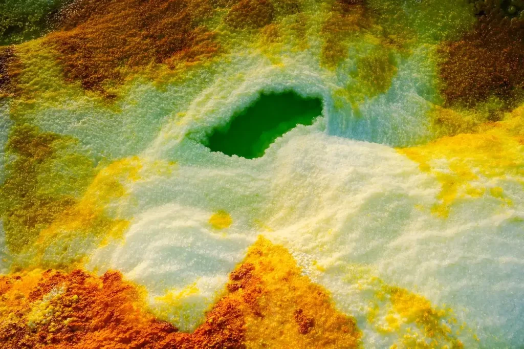
If one single spot defines the Danakil Depression’s reputation, it’s Dallol. This geothermal field is famous for its surreal, almost toxic-looking colors, acid-green pools, sulfur-yellow crusts, and mineral terraces in shades that don’t look like they belong on Earth.
The chemistry is real, not a photo filter: highly acidic, super-saturated brine bubbles up through the salt crust, depositing minerals as it evaporates. The environment is so extreme that researchers have studied Dallol as an analog for the kinds of conditions that might have supported early microbial life and, by extension, what similar chemistry might look like on Mars.
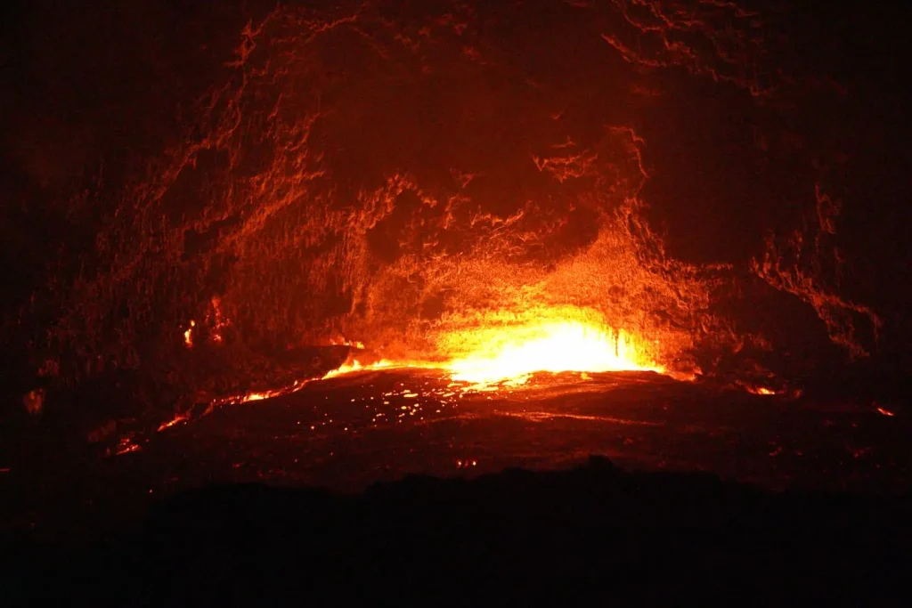
Erta Ale is a shield volcano within the Danakil Depression, notable for having one of the very few permanent lava lakes on Earth. Most volcanic eruptions are short-lived events; Erta Ale’s molten lake has persisted, in various states, for decades.
Visitors who make the overnight trek to its crater rim are rewarded with the sight of the lake glowing and churning in the dark – widely regarded as one of the most dramatic sights in the region.
At the depression’s lower elevations, ancient seawater has evaporated over millennia, leaving behind vast white salt flats around Lake Karum (also called Lake Assale). These flats aren’t just scenic – they’re an active mining site, and have been for generations.
Despite the extreme conditions, the Danakil Depression is home to the Afar people, a nomadic ethnic group whose language belongs to the Cushitic branch of the Afro-Asiatic family. Afar society is traditionally organized into clans, with wealth measured largely in livestock.
Salt has long been the region’s economic backbone. Afar workers cut slabs of salt by hand from the flats and load them onto camel caravans for transport to highland markets – a practice that has continued largely unchanged for centuries, even as tourism has grown around it.
Visiting Afar communities is possible on most Danakil tours, but it’s worth remembering these are people going about daily work, not a staged attraction – a respectful, low-impact approach goes a long way.
Yes, in several distinct ways, and it’s worth being honest about them rather than glossing over them for the sake of adventure appeal:
Because of all this, independent travel isn’t really viable – every reputable route into the region goes through a licensed local operator with an armed escort where required.
Government travel advisory for the Afar Region, Ethiopia
The most tolerable window is roughly November through February, when daytime temperatures are merely brutal instead of genuinely dangerous. Visiting during the peak summer months (April through September) means routinely facing highs well above 45°C, which is a very different experience.
Most Danakil Depression tours run 2 to 4 days and start from Mekele, the nearest major city. A typically common 3 days danakil itinerary looks like:
Are you planning a trip to Ethiopia?
Conditions are basic by design – this is not a resort environment. Plan for:
The Danakil Depression is one of the rare places where the science and the spectacle are the same story: the very tectonic forces splitting Africa apart are what create the lava lakes, acid springs, and salt flats that make this landscape so unforgettable. It’s not an easy place to visit, and it shouldn’t be treated casually – but for travelers and geology enthusiasts willing to plan carefully, few places on the planet feel quite so much like standing on the edge of something still being made.
Are you planning your ethiopian adventure to the Danakil Depression? Feel free to contact us or book our Three Days Danakil Depression Itinerary.
Get ready to dive into a journey unlike any other with our 3-Day Danakil Depression Tour Itinerary. A high-octane adventure across some of Earth’s….
Itinerary DetailsAre you ready for an adventure of a lifetime? Join us on this 2-days tour to the Danakil depression, one of the most spectacular….
Itinerary Details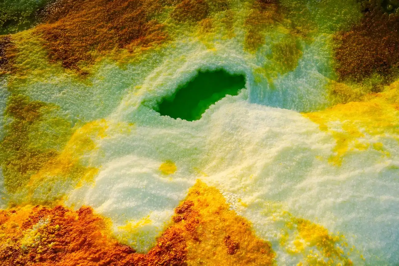
The Omo Valley, often more precisely called the Lower Omo Valley, is a place like no other. Home to a number of tribal communities,….
Learn More
Meet the beating heart of Africa in Addis Ababa – home to the African Union, scores of foreign embassies and a pulse you’ll feel….
Learn More
A crown-jewel of Ethiopia and a UNESCO World Heritage Site, Simien Mountains offers some of the world’s finest trek-routes, unique wildlife..
Learn More
Free itinerary consultation – no obligation, typically a reply within 3 minutes.